SpearXAgro – The Next-Generation Smart Agri-Drone for Precision Farming
AI-powered UAV scans spot stress early, saving your yields and inputs.
The EU Agriculture Challenges and SpearXAgro solutions
1. Inefficient Resource Use → Wasted Inputs, Higher Costs.
Problem:
Traditional farming often applies water, fertilizers, and crop protection uniformly across entire fields-even where they’re not needed. Studies show up to 30% of inputs are wasted due to lack of spatial intelligence, driving up costs and environmental impact.
SpearXAgro Solution:
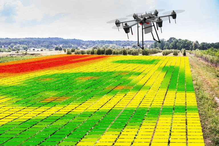
By mapping actual plant needs at 2 - 5 cm resolution, SpearXAgro enables true variable-rate application (VRA). Farmers spray, irrigate, or fertilize only where and when necessary-cutting input costs by 15 - 30% while maintaining or improving yields.
2. Late Detection of Crop Stress → Irreversible Yield Loss
Problem:
Diseases, pests, water stress and nutrient deficiencies are typically spotted only after visual symptoms appear - often 7-14 days after the problem began. By then, damage is done and reactive treatment is less effective.
SpearXAgro Solution:
Using mutispectral cameras LWIR (thermal), SWIR (moisture/biochemistry), and UV (biological activity): SpearXAgro detects physiological stress 5 -10 days before symptoms are visible. This early warning allows preventive or targeted intervention, preserving yield potential and crop quality.
3. Compliance Pressure from EU Green Deal & CAP
Problem:
The EU’s Farm to Fork Strategy mandates a 50% reduction in pesticide use and 20% reduction in fertilizer use by 2030. Meanwhile, the new CAP requires digital documentation of sustainable practices to qualify for subsidies. Many farms lack tools to measure, prove and optimize their environmental performance.
SpearXAgro Solution:
SpearXAgro generates verifiable, geotagged maps of input reduction, stress mitigation, and field health - perfect for CAP digital reporting. It empowers farmers to meet regulatory targets proactively, not reactively, while safeguarding income from EU subsidies.
4. Labor Shortages & Rising Scouting Costs
Problem:
Manual field scouting is time-consuming, subjective and increasingly unaffordable. Skilled agronomists are scarce and walking hundreds of hectares is impractical - especially during critical growth stages.
SpearXAgro Solution:
A single 45-minute autonomous flight can inspect a lot of hectares with greater consistency and detail than a human team. The system automates data collection and analysis, freeing agronomists to focus on interpretation and strategy, not legwork.
5. Inadequate or Inaccessible Crop Data
Problem:
Satellites offer low resolution (5-30 m/px) and suffer from cloud cover. RGB drones only show what’s already visible. Ground sensors provide point data, not field-wide coverage. Result: farmers operate with incomplete or outdated information.
SpearXAgro Solution:
SpearXAgro delivers high-resolution (2-5 cm/px), multi-physiological data on demand-combining thermal, moisture, and biological insights in one flight. Data is processed onboard within minutes, with no internet required, ensuring timely decisions even in remote areas.
6. Difficulty Adapting to Climate Volatility
Problem:
Unpredictable droughts, heatwaves, and erratic rainfall are becoming the norm in Europe. Farmers struggle to adjust irrigation or agronomic practices in real time.
SpearXAgro Solution:
Daily or weekly LWIR-based thermal monitoring reveals micro-variations in crop water status, enabling dynamic irrigation scheduling. SWIR data tracks how crops respond to stress over time, supporting long-term resilience planning.
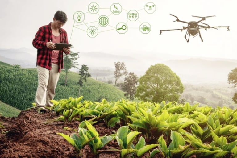
How it works
1. Autonomous Mission Planning
Using the SpearXAgro Portal™ app, define your field boundaries and select your inspection goal-whether it’s irrigation audit, nutrient profiling or disease screening. The system auto-generates an optimized flight path with RTK-precise waypoints.
2. Multi-Spectral Data Capture
The SpearXAgro UAV takes off autonomously and flies the mission at 40-120 m AGL, simultaneously capturing geotagged, calibrated imagery across four spectral bands:
RGB (visual reference & plant structure),
LWIR (8 -14 μm for canopy temperature),
SWIR (900 - 1700 nm for moisture & biochemical content),
UV (320 - 400 nm for biological surface activity).
All data is timestamped, GNSS-RTK geolocated and IMU-stabilized for sub-pixel alignment.

3. Onboard Edge AI Processing
Within minutes of landing - or even mid-flight - the integrated NVIDIA AI SoC processes raw data using lightweight deep learning models trained on EU crop datasets.
The system:
Fuses multi-spectral inputs into unified stress indicators,
Classifies anomalies by type (e.g., drought vs. fungal vs. nutrient),
Generates high-resolution agronomic maps (2-5 cm/px) with confidence scores.
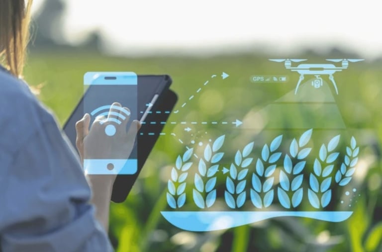
4. Actionable Intelligence Delivered
Results appear instantly in your SpearXAgro Portal™ app dashboard: interactive maps, zone summaries and treatment recommendations. Export VRT-ready prescription files (Shapefile, GeoJSON, ISOXML) or push directly to compatible machinery (John Deere, Claas, Amazon). No cloud dependency. No waiting. Just precision decisions - today.
Who will use SpearXAgro? (End Users)
SpearXAgro is designed for professionals who manage land at scale and need timely, reliable and regulatory-compliant agronomic intelligence:
1. Large-Scale Arable Farmers
Needs: Reduce input costs, comply with CAP digital reporting, optimize harvest timing.
Value: Automates scouting across thousands of hectares; replaces manual labor; supports Green Deal compliance.
2. Viticulture & Horticulture Estates
Needs: Early disease detection (mildew, botrytis), sugar/ripeness monitoring, labor optimization.
Value: UV + LWIR detects infections before visual symptoms; SWIR predicts optimal harvest windows for premium pricing.

3. Agri-Service Providers & Co-ops
Needs: Offer high-value drone analytics to member farms; differentiate from RGB-only competitors.
Value: Turnkey platform with white-label reporting; scalable across multiple clients.
4. Agricultural Research Institutes & Breeders
Needs: High-frequency, non-invasive phenotyping; multi-spectral trait correlation.
Value: Scientific-grade data with precise geotagging and sensor calibration for trial plots.
5. Organic & Regenerative Farms
Needs: Minimize chemical use, prove sustainability claims, monitor cover crops.
Value: Enables targeted interventions without blanket spraying-aligning with organic certification standards.
Why This Matters for EU Agriculture ?
SpearX Agriculture directly supports the EU’s strategic goals:
Green Deal & Farm to Fork: Cut fertilizer/pesticide use through precision.
Digital CAP: Provide verifiable, geolocated field data for subsidy claims.
Resilience: Help farmers adapt to climate volatility with real-time stress monitoring.
Sovereignty: EU-developed, EU-hosted, EU-compliant - no reliance on non-EU tech stacks.

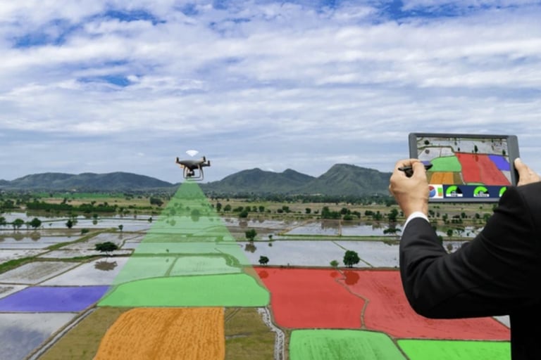
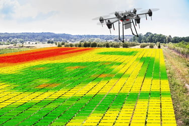
Precision aerial views revealing crop health and stress patterns.
Join the Future of European Agriculture
SpearXAgro is more than a drone - it’s a new standard for intelligent, sustainable farming in the EU.
If you’re a farmer, agronomist, or agri-service provider:
Stop guessing. Start knowing. With SpearXAgro, you gain early visibility into crop health, cut input costs, comply with Green Deal requirements and protect your yields - before problems become losses. Contact us and see the unseen.
If you’re an investor or strategic partner:
Precision agriculture in Europe is a €10B+ market - and growing. SpearXAgro combines proven aerospace-grade engineering (from the SPEARX.EU dual-use ecosystem), EU-compliant autonomy and a clear path to scalability across 27 member states. We’re building not just a product-but a sovereign, sustainable agritech platform for Europe.
We’re actively seeking strategic investment and partnerships to accelerate production, expand our agro-AI models and bring SpearXAgro to farms across the continent.
Contact us
Contact
© 2025. All rights reserved.
Related
SpearX UAV Project www.spearx.eu
GEOCOM CO LLC www.geocomco.eu
Sofia city, Bulgaria, EU